Geocoding Software: Online Tool or API? How to Choose
Published
You have a list of addresses, and you need to see them on a map. The program that finds their spot is called geocoding software. Today it is almost always an online service. What you choose is how you use it: on a web page, or from your own app.
1600 Pennsylvania Avenue NW, Washington, DC becomes 38.8976, -77.0366.Table of contents
- What Does Geocoding Software Do?
- Three Ways to Use a Geocoding Service
- Which One Do You Need?
- What to Check Before You Choose
- How to Geocode a List Online with GeoSearch.online
- Frequently Asked Questions
What Does Geocoding Software Do?
It finds where an address is. The answer is a pair of coordinates. Coordinates are two numbers, latitude and longitude, that point to one spot on the map.
The service compares your address with its own address data. Then it returns the best match and its coordinates. Here are three real results from Address to Lat Lon:
| Your address | Latitude | Longitude |
|---|---|---|
| 1600 Pennsylvania Avenue NW, Washington, DC 20500 | 38.8976 | -77.0366 |
| 20 W 34th St, New York, NY 10001 | 40.7491 | -73.9861 |
| 400 Broad St, Seattle, WA 98109 | 47.6205 | -122.3493 |
The White House, the Empire State Building and the Space Needle. Looked up on November 11, 2026.
It also works the other way. Finding the address for a pair of coordinates is called reverse geocoding.
Three Ways to Use a Geocoding Service
The service does the same job every time. The difference is how you reach it.
| Way | What you do | Good for | You need |
|---|---|---|---|
| A lookup page | Type one address, see the coordinates and a map | One address or one point | A web browser |
| An upload tool | Upload a spreadsheet, download it with coordinates | A list, once or now and then | A file with your addresses |
| An API | Your app sends addresses and gets coordinates back | Apps and websites that look up addresses all the time | A little code and a key |
One Address: a Lookup Page
Type the address and click Search. You see the coordinates and the place on a map. On GeoSearch.online, this is Reverse Address Lookup.
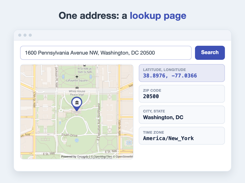
One address in, coordinates and details out. A simplified view.
A lookup page is good for quick checks:
- A single address: a new customer, a meeting place, a parcel that went to the wrong door.
- More than coordinates: Reverse Address Lookup also shows the ZIP or postal code, the city, the state and the time zone.
- The other way round: type a latitude and longitude, and you get the address.
It works one address at a time. With 30 addresses or more, copying each result by hand gets slow. That is when an upload tool helps.
A List: an Upload Tool
Upload your spreadsheet, choose the address columns, and download the result. There is nothing to install and no code to write.
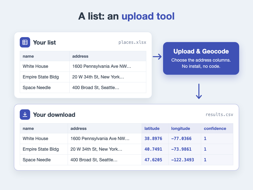
Your columns stay. The coordinates are added next to them.
A few things make the result better:
- One address per row, with a header row that names the columns.
- Full addresses: street and house number, city, and postal code or country. "Main St 12" alone could be in hundreds of towns.
- Your own columns, like names or customer IDs, so you can match each result to its row later.
An upload tool fits a list you geocode once, or now and then, for example a member list before the yearly meeting. Free amounts, prices and file types differ from site to site, so check them first. If new addresses arrive every day, uploading by hand each time gets tiring. That is a job for an API.
Inside an App: an API
API stands for "application programming interface". It is a door for programs, not for people. Your app sends an address and gets coordinates back, without anyone clicking. You get a key from the service, so it knows who is asking.
For a long time, this meant hiring a programmer. That has changed. AI coding assistants can now write most of the code from a plain description, for example: "Read my address list, get coordinates for each row from this geocoding API, and save the result." You still need the key, and you should keep it private. Test the result on a few addresses before you use it on all of them.
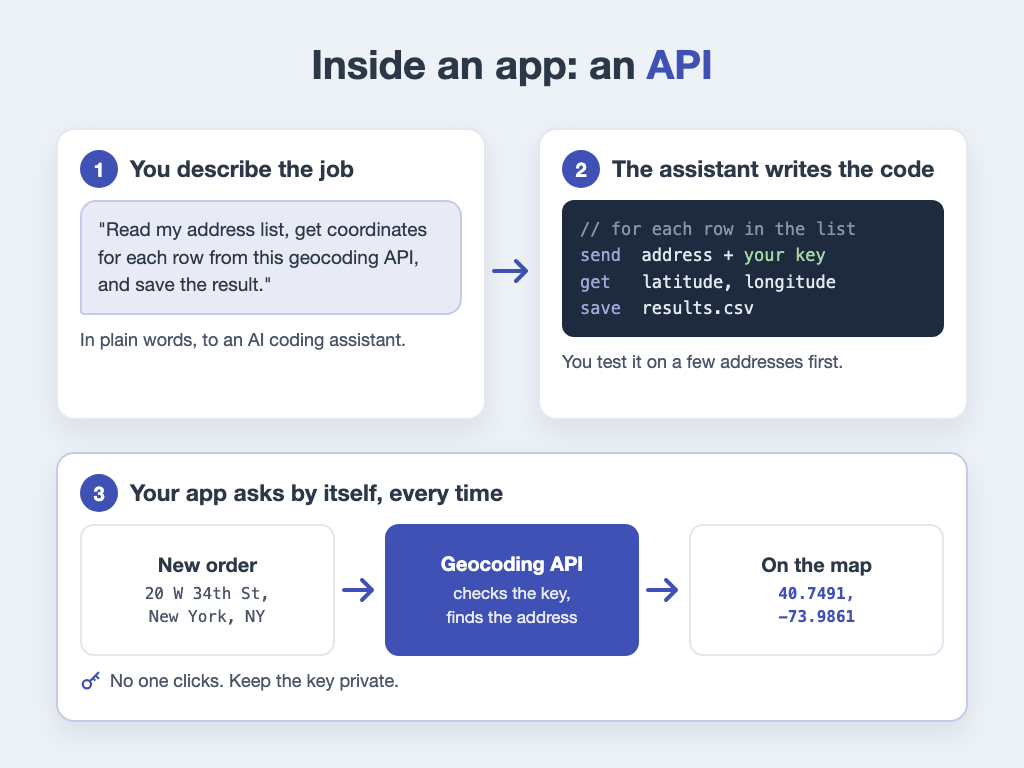
Describe it, let an AI assistant write the code, and the app does the rest.
Many companies offer a geocoding API. A few of them, in alphabetical order:
- Esri ArcGIS geocoding service
- Geoapify Geocoding API
- Google Maps Platform Geocoding API
- HERE Geocoding and Search API
- Mapbox Geocoding API
- OpenCage Geocoding API
They differ in their free amount, prices, address data and terms of use, for example whether you may store the results. Read these on each provider's own pages before you choose. Links checked on November 11, 2026. The tools on GeoSearch.online use the Geoapify Geocoding API.
Which One Do You Need?
Ask yourself how many addresses you have and how often you need them.
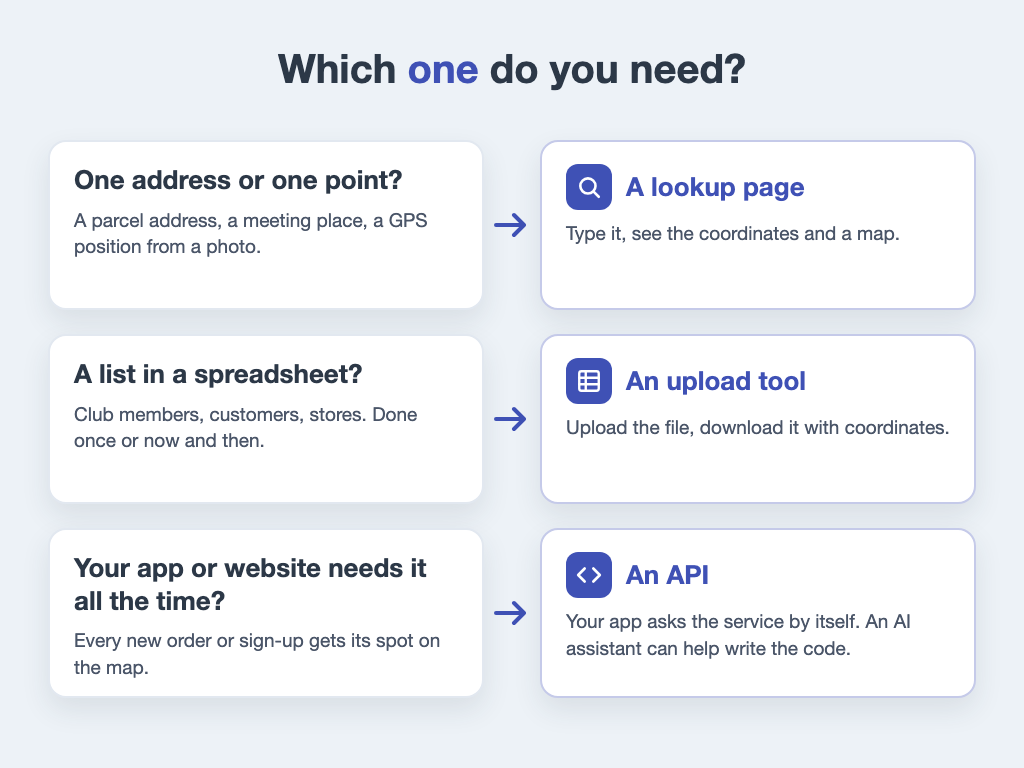
One address, a list, or an app: each has its own way.
A school project with ten places? A lookup page is enough. A club with 800 members? Upload the list. An online shop that checks every new order? That is a job for an API.
What to Check Before You Choose
Services look alike from the outside. These questions show the difference:
- How much is free? Count your rows. Check the free amount, the price per row and any minimum payment.
- Which files work? Can you upload your file as it is? What format do you get back?
- Do your own columns stay? You want your names and IDs next to the coordinates.
- Is there a match score? A score helps you find the rows that need a second look.
- Where does the data come from? The license tells you if you may reuse the results, for example in a report.
- What happens to your file? Check how long it is stored and when it is deleted.
How to Geocode a List Online with GeoSearch.online
Here is the upload way, step by step, with Address to Lat Lon.
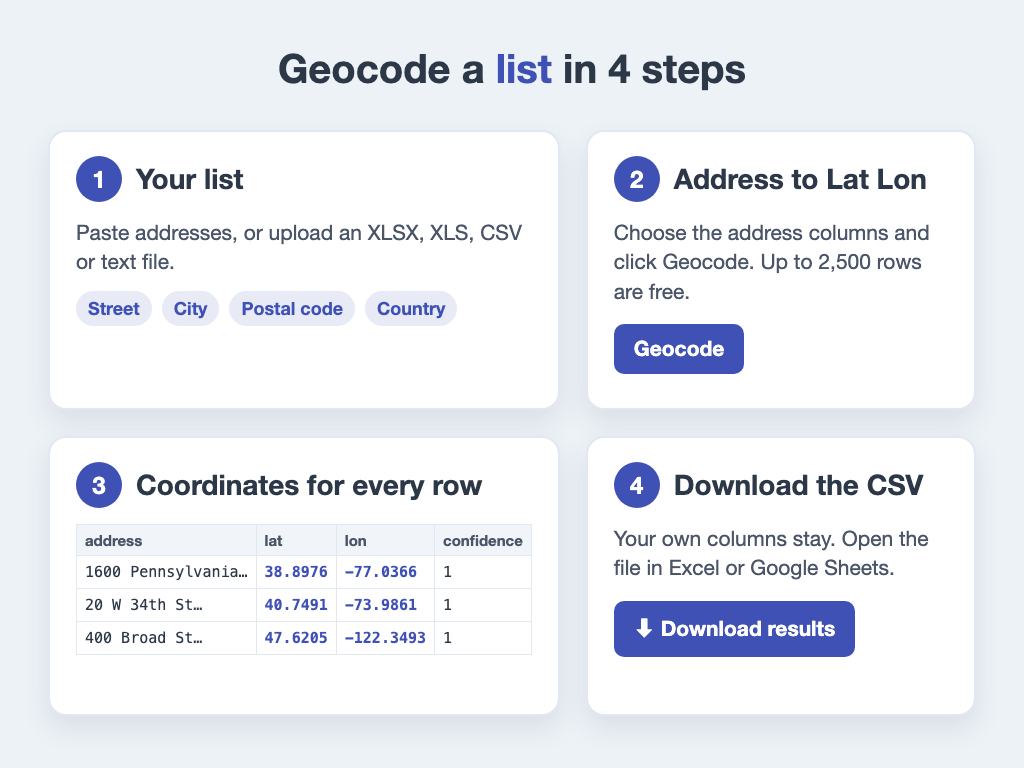
From your address list to a file with coordinates.
- Paste your addresses, or upload an XLSX, XLS, CSV or text file.
- Choose the columns: street, city, postal code, country, or one full address column.
- Click Geocode. Free runs work in batches of 500 rows, with a short pause between batches.
- Download the results as a CSV file. Your own columns stay. New columns hold the latitude, the longitude, a confidence score from 0 to 1, and the data source with its license.
The answers to the checklist, for GeoSearch.online:
- Free: up to 2,500 rows per run, with no signup and no credit card.
- Bigger files: €1 per 1,000 rows, with a €20 minimum. You pay once, with no subscription. See Pricing.
- Who does the work: our servers do the lookup. Paid jobs run in the background, and you get an email with the download link.
- Your file: it is deleted automatically after 7 days.
Only one address to check? Use Reverse Address Lookup. It's free.